
Dennis Wingo: Here are our Madrid Lunar Orbiter V tapes after their completion.! (h/t to James Snyder for catching the autocorrect snafu). Larger view

Official website of the Lunar Orbiter Image Recovery Project (LOIRP)
Dennis Wingo: Here are our Madrid Lunar Orbiter V tapes after their completion.! (h/t to James Snyder for catching the autocorrect snafu). Larger view


Dennis Wingo: These two images here were captured from a frame let of our W5-155 tape, which is from image LOV-041M. The original image, at LPI is here. This is what our tiny blow up of that region looks like. We have both the raw (bottom) and the inverted (top) positive image, but with no other processing. We are blown away with what it looks like on the screen. Click on images to enlarge. We are looking forward to start seeing some image output!
On 11 August 1967 Lunar Orbiter 5 took one medium resolution and three high resolution images of the central uplift features inside crater Copernicus. These photos exhibit some processing artifacts (splotches) resulting from the film development process aboard the spacecraft. The imagery comparison discussed in the LOIRP poster presentation “The Lunar Orbiter Image Recovery Project (LOIRP) Comparison of LO Copernicus Central Uplift with LRO LROC Mosaic“ at the 2012 Lunar Science Forum is taken from frame h1 – lower right hand portion.

This newly retrieved high resolution image, frame 5151_H3, was taken by Lunar Orbiter 5 on 11 August 1967 at 11:18 GMT LPI reference. Images: [large at LOIRP] [Very Large at NASA NLSI]

This newly retrieved high resolution image, frame 5151_H2, was taken by Lunar Orbiter 5 on 11 August 1967 at 11:18 GMT LPI reference. Images: [large at LOIRP] [Very Large at NASA NLSI]

This newly retrieved high resolution image, frame 5151_H1, was taken by Lunar Orbiter 5 on 11 August 1967 at 11:18 GMT LPI reference. Images: [large at LOIRP] [Very Large at NASA NLSI]

NASA Lunar Orbiter 5 image of the plateau west-northwest of Marius crater on the Moon. Larger Image.
One of the supposedly best understood and least interesting landscapes on Mars is hiding something that could rewrite the planet’s history. Or not. In fact, about all that is certain is that decades of assumptions regarding the wide, flat Hesperia Planum are not holding up very well under renewed scrutiny with higher-resolution, more recent spacecraft data.
“Most scientists don’t want to work on the flat things,” noted geologist Tracy Gregg of The University at Buffalo, State University of New York. So, after early Mars scientists decided Hesperia Planum looked like a lava-filled plain, no one really revisited the matter and the place was used to exemplify something rather important: The base of a major transitional period in the geologic time scale of Mars. The period is aptly called the Hesperian and it is thought to have run from 3.7 to 3.1 billion years ago.
But when Gregg and her student Carolyn Roberts started looking at this classic Martian lava plain with modern data sets, they ran into trouble.
“There’s a volcano in Hesperia Planum that not many people pay attention to because it’s very small,” Gregg said. “As I started looking closer at the broader region — I can’t find any other volcanic vents, any flows. I just kept looking for evidence of lava flows. It’s kind of frustrating. There is nothing like that in the Hesperia Planum.”
“A likely cause of this trouble is the thick dust that blankets Hesperia Planum,” she said. “It covers everywhere like a snowfall.”
So she turned her attention to what could be discerned on Hesperia Planum: about a dozen narrow, sinuous channels, called rilles, just a few hundred meters wide and up to hundreds of kilometers long. These rilles have no obvious sources or destinations and it is not at all clear they are volcanic.

NASA/GSFC/Arizona State University Lunar Reconnaissance Orbiter image “Secrets of Schroeteri” Vallis Schroeteri is a sinuous rille on the moon; its inner rille diverges from the primary rille near arrow. Larger Image.

THEMIS daytime infrared image mosaic (courtesy of ASU/NASA/JPL) of Mars with north is at the top. Image is centered at 116.3 deg E and 25.0 deg S Larger Image. “The question I have is what made the channels,”; said Gregg. Was it water, lava, or something else? “There are some lavas that can be really, really runny. And both are liquids that run downhill.” So either is a possibility.
To begin to sort the matter out, Gregg and Roberts are now looking for help on the Moon. Their preliminary findings will be presented Wednesday, 12 Oct., at the meeting of The Geological Society of America in Minneapolis.
“On the Moon we see these same kinds of features and we know that water couldn’t have formed them there,” Gregg said. So they are in the process of comparing channels on the Moon and Mars, using similar data sets from different spacecraft, to see if that sheds any light on the matter. She hopes to find evidence that will rule out water or lava on Hesperia Planum.
“Everybody assumed these were huge lava flows,” said Gregg. “But if it turns out to be a lake deposit, it’s a very different picture of what Mars was doing at that time.” It would also make Hesperia Planum a good place to look for life, because water plus volcanic heat and minerals is widely believed to be a winning combination for getting life started.
“The ‘volcanic’ part is an interpretation that’s beginning to fall apart,” said Gregg. “What is holding up is that the Hesperian marks a transition between the Noachian (a time of liquid water on the surface and the formation of lots of impact craters) and the Amazonian (a drier, colder Mars).”
She has found that other scientists are interested in her work because of its possible implications on the Mars geological time scale. Gregg is not worried that Mars history will need to be rewritten, but she does suspect that Hesperia Planum is a lot more complicated than people has long thought.
Presentation Time: 3-3:15 PM, Wed., 12 Oct. 2011 Where: Minneapolis Convention Center, Room L100H-J What: 284-6: Sinuous Rilles in Hisperia Planum, Mars: Water, Lava, or Something Else?
Session No. 284: Terrestrial Analogs in Solar System Studies

This image was taken by Lunar Orbiter V on 9 August 1967 at at 02:42:34 GMT from an altitude of 5,068.6 km. Click on image for [larger labeled view] [much larger unlabeled view] [LPI source imagery]

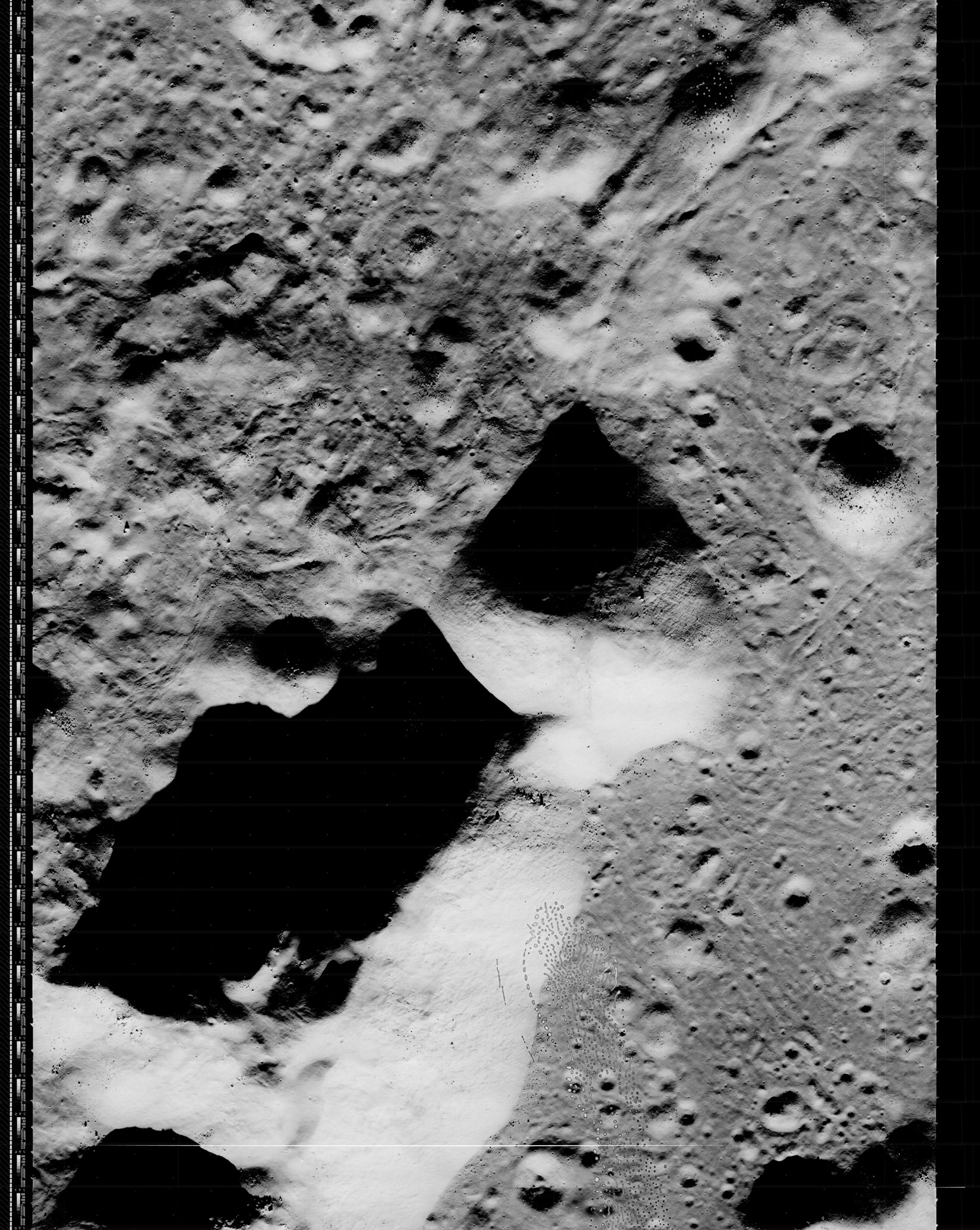
This image represents a portion of the central uplift within the crater Copernicus. The image, LOV-152-H1, was taken by Lunar Orbiter V on 16 August 1967 at an altitude of 103 km. The spacecraft was looking straight down at the crater as it snapped this picture series. The resolution of this image is 2.2 meters/pixel. [Click on image to enlarge]
Below, you can see the increase in contrast and resolution that LOIRP has attained when you compare the high resolution USGS image (left) and the one obtained by LOIRP on 10 December 2009 (right). [Click on image to enlarge]


This image (LO_V-5030) of Earth was taken on 8 August 1967 at 09:05:11 GMT by the Lunar Orbiter V spacecraft in orbit around the Moon at an altitude of 5,872.85 km. This image has been described as being the first image ever taken of a “full Earth” from space. [Larger image]
Lunar Orbiter V was launched on 1 August 1967 arrived in a nearly polar orbit on 5 August at 12:48 p.m. EDT. Images were taken between 6-19 August and were sent back to Earth on 27 August 1967.
This is the orientation of Earth as Lunar Orbiter V snaped its photo from Lunar Orbit

It is easy to make out a number of geographic features in this image. [Larger image]

In addition, you can see that the detail of the clouds – especially over the Indian Ocean is much greater in this image. Further processing of this image should yield even greater detail. [Larger image]

This is one of only three images of the Earth taken from the five lunar orbiter spacecraft. In its full resolution form, you can easily see Sicily, Cyprus, the Caspian Sea, lake Bakial, and other features such as the Nile delta. The Chinese coast is visible on the upper right as well as India and Ceylon in the center of the image. In the lower right the Indonesian islands are also visible. The estimated resolution of the image on the Earth is approximately 5 kilometers.
This is the 2 inch tape reel on which this image was stored. Note on the label [much larger image] that “L.O.E.” refers to “Lunar Orbiter E” aka “Lunar Orbiter V”. The tape was recorded on day 238 of 1967 local time i.e. 26 August 1967. Starting at 06:34:38 GMT and ending at 07:26:10 GMT

This image was not in the original mission plan. According to Destination Moon: A History of the Lunar Orbiter Program (NASA TM X-3487):
“Photography commenced at 7:22 p.m. EDT on August 6. At this time the spacecraft took its first photograph of the Moon at a distance of about 6,000 kilometers from the lunar surface. The target was a previously unknown area of the far side. Then it executed a maneuver early on August 7 [294] that lowered the perilune to 100 kilometers while maintaining a 6,023-kilometer apolune. The spacecraft continued farside photography, exposing eighteen out of nineteen frames during the first part of the mission. The nineteenth was a “film set” frame, moved through the photo subsystem in an eight hour interval to prevent film from setting and Bimat from drying out. While this was a planned item In the film’s budget, the decision which program officials made early on August 7 changed the next scheduled “film set” frame significantly. They decided to use it to take a photograph of the Earth with the 610 mm high-resolution camera lens instead of passing It unexposed through the system.
Site VA-9, as the Earth photograph was identified, had not been in the original plan. Program officials decided, however, that the position of Lunar Orbiter V relative to the Moon and the Earth and the Earth’s position relative to the Sun afforded a very fine opportunity to take such a picture. The Langley program planning staff together with flight controllers implemented a plan to make an Earth photograph when the spacecraft neared apolune between orbits 7 and 8. Since the spacecraft’s orbit geometry kept it in view of Earth at all times, the Moon would not appear in [295] the photograph.
Exactly seven hours twenty-three minutes elapsed between the exposure of the previous photograph of Site VA-8 and the moment when Lunar Orbiter V’s camera made the historic picture of the nearly full Earth on August 8 at about 9:05 Greenwich Mean Time. Shutter speed was 1/100 second, but the Earth’s high albedo caused some overexposure of the film. This was unavoidable. Later Langley Research Center photography specialists successfully applied image enhancement techniques, using magnetic tape video records of the readout of the photograph, to bring out details which would not have shown up in a negative reconstructed from the raw readout data. (Note that enhancement techniques did not involve any “doctoring” of photographic data in order to “show” something which was not there.)
Approximately 149° of arc of the Earth’s surface appeared clearly in the photograph. It illustrated the possible synoptic weather observations that a satellite could conduct in cislunar space or that could be made from the Moon.”
This image has been recovered in its original high resolution format by LOIRP staff from original Lunar Orbiter project data tapes using restored tape drive hardware and will eventually be submitted to the PDS (Planetary Data System).
A full resolution version of this image is now online at the NASA Lunar Science Institute here (1.07 GB TIFF)
The first image recovered by LOIRP was the iconic “Earthrise” image taken by Lunar Orbiter a year prior to this Lunar Orbiter V image.
The Lunar Orbiter Image Recovery Project (LOIRP) is located at the NASA Ames Research Center in Moffett Field, CA. Funding and support for this project has been provided by NASA Exploration Systems Mission Directorate, NASA Innovative Partnerships Program, NASA Lunar Science Institute, NASA Ames Research Center, Odyssey Moon LLC, SkyCorp Inc., and SpaceRef Interactive Inc.
For more information on the Lunar Orbiter Image Recovery Project (LOIRP) visit https://moonviews.wpenginepowered.com
For information on NASA’s Lunar Science Institute visit http://lunarscience.arc.nasa.gov/
For information on NASA’s Exploration Systems Mission Directorate visit http://www.nasa.gov/exploration/
This image (LO_V-5030) of Earth was taken on 8 August 1967 at 09:05:11 GMT by the Lunar Orbiter V spacecraft in orbit around the Moon at an altitude of 5,872.85 km. This image has been described as being the first image ever taken of a “full Earth” from space. This is one of the photos issued by NASA Public Affairs.


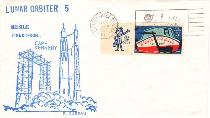
 Lunar Orbiter 5, the last of the Lunar Orbiter series, was designed to take additional Apollo and Surveyor landing site photography and to take broad survey images of unphotographed parts of the Moon’s far side. It was also equipped to collect selenodetic, radiation intensity, and micrometeoroid impact data and was used to evaluate the Manned Space Flight Network tracking stations and Apollo Orbit Determination Program. The spacecraft was placed in a cislunar trajectory and on August 5, 1967 was injected into an elliptical near polar lunar orbit 194.5 by 6,023 kilometres (120.9 3,743 mi) with an inclination of 85 degrees and a period of 8 hours 30 minutes. On August 7 the perilune was lowered to 100 kilometres (62 mi), and on August 9 the orbit was lowered to a 99-by-1,499-kilometre (62 931 mi), 3 hour 11 minute period.
Alternate Names: Lunar Orbiter-E, 02907
Launch Date: 1967-08-01
Launch Vehicle: Atlas-Agena D
Launch Site: Cape Canaveral, United States
Mass: 385.6 kg
Nominal Power: 375.0 W
Launch/Orbital information for Lunar Orbiter 5
Experiments on Lunar Orbiter 5
Data collections from Lunar Orbiter 5
Description
Lunar Orbiter 5, the last of the Lunar Orbiter series, was designed to take additional Apollo and Surveyor landing site photography and to take broad survey images of unphotographed parts of the Moon’s far side. It was also equipped to collect selenodetic, radiation intensity, and micrometeoroid impact data and was used to evaluate the Manned Space Flight Network tracking stations and Apollo Orbit Determination Program. The spacecraft was placed in a cislunar trajectory and on 5 August 1967 was injected into an elliptical near polar lunar orbit 194.5 km x 6023 km with an inclination of 85 degrees and a period of 8 hours 30 minutes. On 7 August the perilune was lowered to 100 km and on 9 August the orbit was lowered to a 99 km x 1499 km, 3 hour 11 minute period. The photographic portion of the mission ended on 18 August.


Click on card to enlarge

