Boulder Trails On The Moon


[Click on image to enlarge] Keith’s note: This image was taken on 21 November 1966 by Lunar Orbiter II at an altitude of 44 miles. The image is taken from frame 92, Framelet 445, and has resolution is 0.98 meters/pixel. As such the large boulder that has left a trail is around 6-7 meters in diameter. The image on the left shows the highest resolution image available online at LPI. On the right is the raw unproceesed image we retrieved this afternoon. While the large boulder’s trail is seen in both images, the details of that trail and the rest of the boulder field are much sharper in our newly retrieved image.
By coincidence this large boulder is very similar in size to “House Rock” a large boulder north of the Haughton Mars Research Station on Devon Island. That’s me standing on top if it.


This rock is a favorite place to pose for photos and was named after the large rock that Astronaut Jack Schmitt posed next to during the Apollo 17 mission.

Comparing USGS, LPI, and LOIRP Image Resolution (Update)

[Click to enlarge] Keith’s note: These images are taken from Lunar Orbiter II image LOII_092H1 Framelet 522. On the left is the highest resolution scanned version available online at LPI (or USGS). On the right is our partially processed version that we retrieved this morning. In addition to providing a much sharper image, note that our new image also allows contrast to be controlled such that features can seen in the areas that are darkened in the older image.
Right now we are focusing on retrieving Lunar Orbiter II images at the request of both LPI and USGS since high resolution (modern) scans have yet to be done for this mission’s images. We hope to have the entire image online later today complete with collapsed lava tubes (?) and giant boulders sitting in the middle of otherwise flat plains. With our recently enhanced (restored) original FR-900 tape drive and its recently restored sister drive we will soon have two fully functional drives in operation and will be able to (eventually) retrieve and release images on a daily basis.
I will be doing a live webcast tomorrow at 1pm PST wherein we give you a tour of our facility and watch as we pull a new image back from history and into the present. Details to follow.

Seeing Boulders on The Moon


[Click on image to enlarge] Keith’s note: Tonight we are testing out our newest Mac computer at the Lunar Orbiter Image Recovery Project located at NASA ARC. We’ll be using this machine (8 processors and 10 TB of storage) to do near-real time processing of imagery once we have pulled it off of original Lunar Orbiter analog data tapes using our restored FR-900 tape drives. We hope to do a live webcast this coming Thursday so that you can look over our shoulders as we bring another image to light for the first time in more than 40 years.
Tonight, as we were flying through a portion of one of the images we came across a boulder field. Here is the image archive at LPI – subframe H3, Framelet 323. The image was taken by Lunar Orbiter II on 20 Nov 1966 at an altitude of 52.2 miles with a ground resolution of 1.14 meters/pixel. The framelet image shown here is approximately 220 meters across. You can clearly make out a number of boulders around 1 meter in size sitting on the surface.

LOIRP Releases Enhanced Restored Version of the “Image of the Century” Plus Additional Subframes of Crater Copernicus

This is a re-release of Life Magazine’s “Image of the Century” from 1966. The performance of our hardware and software image processing methods has been significantly enhanced to remove some of the banding artifacts that are derived from imperfections in the spacecraft image scanning hardware. This image of Copernicus crater was taken from a spacecraft altitude of 45 km (27.1 miles) and is approximately 207.7 km (~125 miles) to the center of the image.
An interesting aspect to this image is that with this oblique view, recent impacts of small craters have much more brightness than older craters of the same size. This suggests the value of oblique photography in doing crater aging studies as well as multispectral remote sensing of excavated materials from the craters. You can view a larger version [900 K JPG] of this image on your screen here. You can download the full resolution image [505 MB TIFF] here at the NLSI.

Continue reading “LOIRP Releases Enhanced Restored Version of the “Image of the Century” Plus Additional Subframes of Crater Copernicus”

Newly Restored “Picture of the Century”: Lunar Orbiter 2’s View of Copernicus

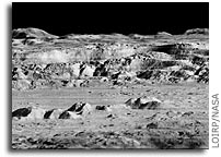
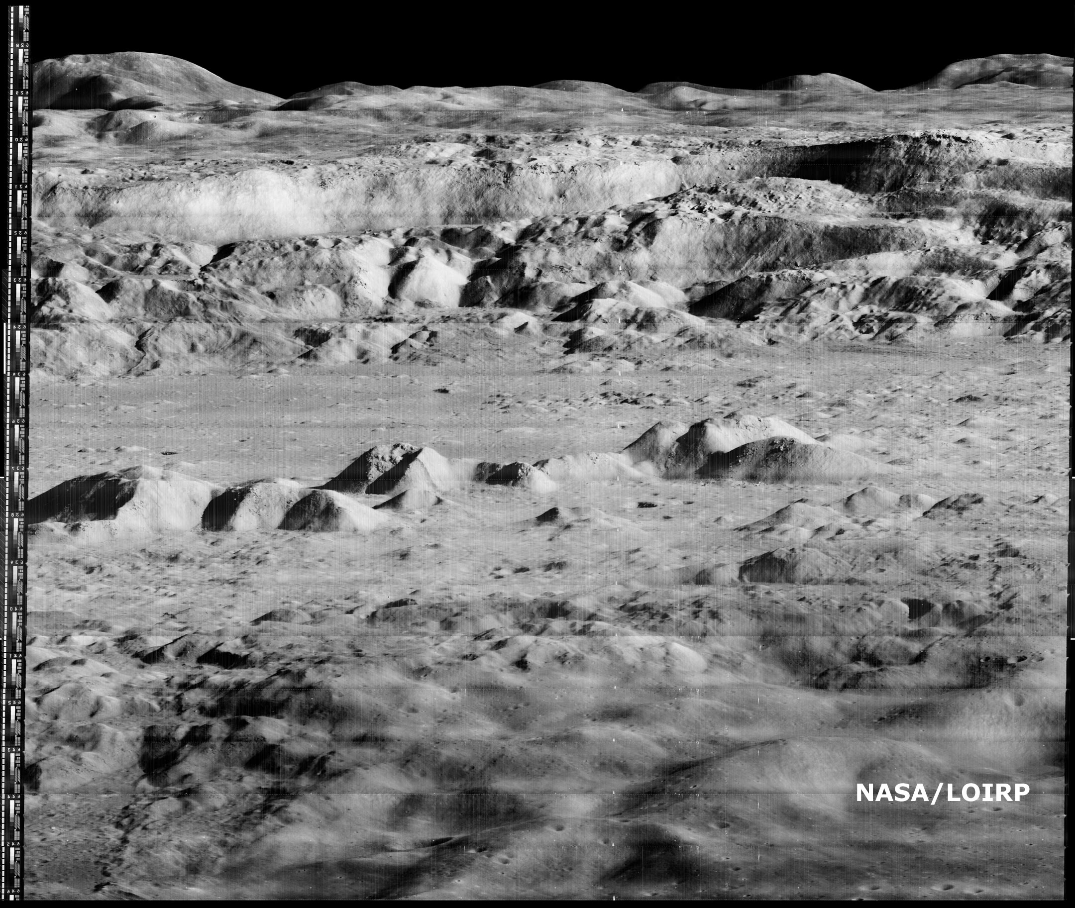
The Lunar Orbiter Image Recovery Project (LOIRP) has released another iconic image taken during the Lunar Orbiter program in the 1960’s. This image, which shows the dramatic landscape within the crater Copernicus was often referred to as the “picture of the century” by many people at the time of its original public release in 1966.
This image was taken by the Lunar Orbiter 2 spacecraft at 7:05 p.m. EST on 24 November 1966 from an altitude of 28.4 miles above the lunar surface, 150 miles due south of Copernicus. At the time this image was originally released most views of the lunar surface involved looking straight down. Little, if any, sense of the true elevation of lunar surface features was usually available. This photo changed that perception by showing the Moon to be a world with tremendous topography – some of it Earth-like, much of it decidedly un-earth-like.
According to Wikipedia: “In 1966 the crater was photographed from an oblique angle by Lunar Orbiter 2 as one of 12 “housekeeping” pictures that were taken to advance the roll of film between possible astronaut landing sites being surveyed. At the time this detailed image of the lunar surface was termed by NASA Scientist Martin Swetnick and subsequently quoted by Time magazine as “one of the great pictures of the century.”
Time magazine said (“A New Look at Copernicus“): “Except for the black sky in the background, the photograph might have been mistaken for a composite of the scenic grandeur of Grand Canyon and the barren desolation of the Badlands of South Dakota. But when it was flashed unexpectedly onto a screen at a meeting of the American Institute of Aeronautics and Astronautics in Boston last week, sophisticated space scientists and engineers recognized the terrain immediately. It was a spectacular close up shot of lunar landscape. That photograph of the moon’s Crater of Copernicus, said NASA Scientist Martin Swetnick, is “one of the great pictures of the century.”
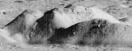
The following image is an interim version, with reprocessing and enhancements being made constantly. A larger, raw version (2.2 GB in size) is now online at NASA’s Lunar Science Institute. Larger view.

If you compare this new image with LPI’s high res version you can clearly see that this new image shows multiple striations in the surface, small boulders, landslides, shadows and a myriad of fine details simply not visible in the original. The LOIRP currently estimates that the resolution of this image is less than 1 meter/pixel. Larger view.

Dennis Wingo, co-lead of the LOIRP will make a presentation on this image and the LOIRP at the Lunar and Planetary Science Conference on Monday, 23 March 2009 at 8:30 am (session 102)
The LOIRP, funded by NASA’s Exploration Mission Systems Directorate and NASA’s Innovative Partnership’s Program, with support from Odyssey Moon, Skycorp Inc., SpaceRef Interactive Inc., ACES, and the NASA Lunar Science Institute, is housed at NASA Ames Research Center at Moffet Field, CA. This project has utilized original analog data tapes and restored tape drives to digitize original Lunar Orbiter project imagery. Utilizing computer technology unavailable at the time the images were originally taken, LOIRP has been able to produce images which greatly exceed the resolution of the images as they were first seen in 1966 and 1967.
The first image released by the LOIRP, the famous “earthrise image”, was made public in November 2008. It is anticipated with the release of this latest image of Copernicus, and further restoration of the original 40 year old hardware, that the pace of additional image releases will now increase.
Further information on the LOIRP can be found at https://moonviews.wpenginepowered.com/
You can follow our image restoration process on Twitter at LunarOrbiter

Apollo Landing Site Ellipse II-P-6


Ellipse II-P-6, located in western Mare Tranquillitatis. The center coordinates for the ellipse are 00 degrees 45 minutes north longitude and 23 degrees 37 minutes east latitude. It was the sixth primary site photographed by Lunar Orbiter II. Surveyor V landed approximately 26 kilometers to the north-northwest from the center of the ellipse.

Apollo Landing Site Ellipse II-P-2


Photograph of surface of moon showing eastern Mare Tranquillitatis Description: Ellipse II-P-2, located in eastern Mare Tranquillitatis. The center coordinates for the ellipse are 2 degress 40 minutes north longitude and 34 degrees 00 minutes east latitude. It was the second primary site photographed by Lunar Orbiter II. It is the eastern most of the Set C Mission I sites.

Apollo Landing Site Ellipse II-P-11


Ellipse II-P-11, located in Oceanus Procellarum. The center coordinates for the ellipse are 3 degrees 30 minutes south longitude and 36 degrees 25 minutes west latitude. It was the eleventh primary site photographed by Lunar Orbiter II. It is the southern most of the Set C Mission I sites.

Apollo Landing Site Ellipse II-P-13


Ellipse II-P-13, located in Oceanus Procellarum. The center coordinates for the ellipse are 1 degree 40 minutes north longitude and 41 degrees 40 minutes west latitude. It was the thirteenth and last primary site photographed by Lunar Orbiter II. It is the western most of the Set C Mission I sites.

Apollo Landing Site Ellipse II-P-8


Ellipse II-P-8, located in Sinus Medii near the center of the moon. The center coordinates for the ellipse are 0 degrees 25 minutes north longitude and 1 degree 20 minutes west latitude. It was the eighth primary site photographed by Lunar Orbiter II. Surveyor VI landed approximately five kilometers to the northwest from the center of the ellipse.

Lunar Orbiter II Mission

The Lunar Orbiter 2 spacecraft was designed primarily to photograph smooth areas of the lunar surface for selection and verification of safe landing sites for the Surveyor and Apollo missions. It was also equipped to collect selenodetic, radiation intensity, and micrometeoroid impact data.
The spacecraft was placed in a cislunar trajectory and injected into an elliptical near-equatorial lunar orbit for data acquisition after 92.5 hours flight time. The initial orbit was 196 by 1,850 kilometres (122 1,150 mi) at an inclination of 11.8 degrees. The perilune was lowered to 49.7 kilometres (30.9 mi) five days later after 33 orbits. A failure of the amplifier on the final day of readout, December 7, resulted in the loss of six photographs. On December 8, 1966 the inclination was altered to 17.5 degrees to provide new data on lunar gravity.

Continue reading “Lunar Orbiter II Mission”

Lunar Orbiter 2 Mission

Alternate Names: Lunar Orbiter-B, 02534
Launch Date: 1966-11-06
Launch Vehicle: Atlas-Agena D
Launch Site: Cape Canaveral, United States
Mass: 385.6 kg
Nominal Power: 375.0 W
Launch/Orbital information for Lunar Orbiter 2
Experiments on Lunar Orbiter 2
Data collections from Lunar Orbiter 2
Description
The Lunar Orbiter 2 spacecraft was designed primarily to photograph smooth areas of the lunar surface for selection and verification of safe landing sites for the Surveyor and Apollo missions. It was also equipped to collect selenodetic, radiation intensity, and micrometeoroid impact data. The spacecraft was placed in a cislunar trajectory and injected into an elliptical near-equatorial lunar orbit for data acquisition after 92.5 hours flight time. The initial orbit was 196 km x 1850 km at an inclination of 11.8 degrees. The perilune was lowered to 49.7 km five days later after 33 orbits. A failure of the amplifier on the final day of readout, 7 December, resulted in the loss of six photographs. On 8 December 1966 the inclination was altered to 17.5 degrees to provide new data on lunar gravity.

Continue reading “Lunar Orbiter 2 Mission”